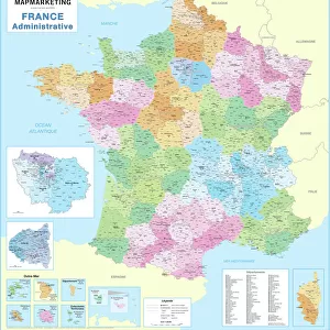
Home > Europe > France > Canton > Tarn
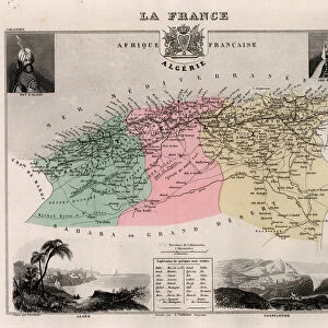
Tarn (Tarn, 81), Midi-Pyrenees (Midi Pyrenees) - France and its Colonies. Atlas illustrates one hundred and five maps from the maps of the depot of war, bridges and footwear and the Navy by M. VUILLEMIN. 1876
, Midi-Pyrenees (Midi Pyrenees) - France and its Colonies. Atlas illustrates one hundred and five maps from the maps of the depot of war, bridges and footwear and the Navy by M. VUILLEMIN. 1876")
![]()
Wall Art and Photo Gifts from Fine Art Finder
Tarn (Tarn, 81), Midi-Pyrenees (Midi Pyrenees) - France and its Colonies. Atlas illustrates one hundred and five maps from the maps of the depot of war, bridges and footwear and the Navy by M. VUILLEMIN. 1876
XEE4144429 Tarn (Tarn, 81), Midi-Pyrenees (Midi Pyrenees) - France and its Colonies. Atlas illustrates one hundred and five maps from the maps of the depot of war, bridges and footwear and the Navy by M. VUILLEMIN. 1876. by Vuillemin, Alexandre (1812-1886); Private Collection; (add.info.: Tarn (Tarn, 81), Midi-Pyrenees (Midi Pyrenees) - France and its Colonies. Atlas illustrates one hundred and five maps from the maps of the depot of war, bridges and footwear and the Navy by M. VUILLEMIN. 1876.); Stefano Bianchetti
Media ID 25216672
© Stefano Bianchetti / Bridgeman Images
Alexandre Vuillemin Atlas Book City Map City Plan General Map Geographical Map Midi Pyrenees Street Plan Tarn 81 Vuillemin Alexandre 1812 1886
FEATURES IN THESE COLLECTIONS
> Arts
> Artists
> Related Images
> Arts
> Portraits
> Pop art gallery
> Street art portraits
> Europe
> France
> Canton
> Pyrenees
> Europe
> France
> Canton
> Tarn
> Fine Art Finder
> Artists
> Alexandre Vuillemin
> Maps and Charts
> Early Maps
> Maps and Charts
> Related Images
> Services
> Royal Navy
EDITORS COMMENTS
This print showcases a stunning geographical map titled "Tarn (Tarn, 81), Midi-Pyrenees (Midi Pyrenees) - France and its Colonies". Created by Alexandre Vuillemin in 1876, this map is part of an atlas that features a total of one hundred and five maps from various sources including the depot of war, bridges and footwear, as well as the Navy. The intricate details and vibrant colors of this engraving bring to life the rich geography of Tarn in the Midi-Pyrenees region of France. The artist's skillful rendering captures every contour, river, and city with precision. This historical piece not only serves as a valuable resource for studying French geography but also offers a glimpse into the artistic talent prevalent during the 19th century. Stefano Bianchetti has masterfully captured this artwork through his lens, preserving its beauty for generations to come. The careful composition highlights both the overall layout of the map as well as smaller details that make it truly remarkable. Whether you are an art enthusiast or a history buff, this print is sure to captivate your imagination and transport you back in time to explore France's colonial past. It serves as a testament to both Vuillemin's expertise in cartography and Bianchetti's skill in capturing fine art through photography.
MADE IN THE USA
Safe Shipping with 30 Day Money Back Guarantee
FREE PERSONALISATION*
We are proud to offer a range of customisation features including Personalised Captions, Color Filters and Picture Zoom Tools
SECURE PAYMENTS
We happily accept a wide range of payment options so you can pay for the things you need in the way that is most convenient for you
* Options may vary by product and licensing agreement. Zoomed Pictures can be adjusted in the Cart.