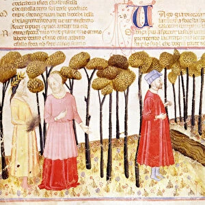
Home > Arts > Artists > P > Polish School Polish School
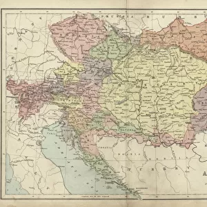
Central Europe showing the historic sites and battlefields of 1792-1813 - Central Europe

![]()
Wall Art and Photo Gifts from Fine Art Finder
Central Europe showing the historic sites and battlefields of 1792-1813 - Central Europe
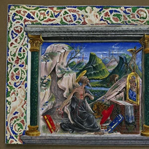
XEE4154372 Central Europe showing the historic sites and battlefields of 1792-1813 - Central Europe indicating historic sites and battlefields from 1792 to 1813 - engraving in " Histoire de France" by Victor Duruy (1811-1894) - 1882 by French School, (19th century); Private Collection; (add.info.: Central Europe showing the historic sites and battlefields of 1792-1813 - Central Europe indicating historic sites and battlefields from 1792 to 1813 - engraving in " Histoire de France" by Victor Duruy (1811-1894) - 1882); Stefano Bianchetti; French, out of copyright
Media ID 23707486
© Stefano Bianchetti / Bridgeman Images
Boheme Croatia Geographical Map Neerlanders North Sea Poland Polish Austria Austrian Austrians Prussia Prussian
FEATURES IN THESE COLLECTIONS
> Arts
> Artists
> I
> Italian School Italian School
> Arts
> Artists
> P
> Polish School Polish School
> Europe
> Austria
> Related Images
> Europe
> Belgium
> Related Images
> Fine Art Finder
> Artists
> French School
> Fine Art Finder
> Artists
> Gustave Dore
EDITORS COMMENTS
This print titled "Central Europe showing the historic sites and battlefields of 1792-1813" takes us on a journey through time. The intricate engraving, originally featured in Victor Duruy's "Histoire de France" transports us to the 19th century when this map was created. The image showcases Central Europe with meticulous detail, highlighting the significant historical sites and battlefields that shaped the region between 1792 and 1813. From Switzerland to Belgium, from Russia to Germany, this map offers a comprehensive overview of the European landscape during this tumultuous period. The artist's skillful rendering brings forth an array of colors that breathe life into each country represented. The borders are clearly defined as we traverse through countries like Austria, Prussia, Poland, Croatia, and France. Notably, it captures key locations such as the North Sea and highlights their importance in shaping political alliances and military strategies during these years. As we delve deeper into this artwork by Stefano Bianchetti, we can't help but appreciate its historical significance. It serves as a visual testament to the complex geopolitical dynamics that unfolded across Central Europe during one of history's most transformative periods. This print is not only visually stunning but also provides valuable insights into European history for enthusiasts or scholars alike. Its presence in any collection would undoubtedly spark curiosity and serve as a reminder of our shared past.
MADE IN THE USA
Safe Shipping with 30 Day Money Back Guarantee
FREE PERSONALISATION*
We are proud to offer a range of customisation features including Personalised Captions, Color Filters and Picture Zoom Tools
SECURE PAYMENTS
We happily accept a wide range of payment options so you can pay for the things you need in the way that is most convenient for you
* Options may vary by product and licensing agreement. Zoomed Pictures can be adjusted in the Cart.