Home > Arts > Artists > O > Oceanic Oceanic
direction, antique, atlantic ocean, close-up, crossing, europe, geography, guidance

![]()
Wall Art and Photo Gifts from Fine Art Storehouse
direction, antique, atlantic ocean, close-up, crossing, europe, geography, guidance
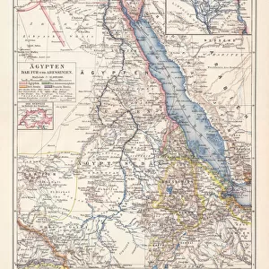
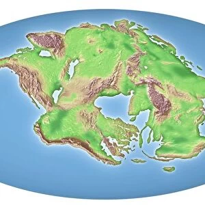
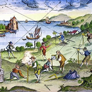
direction, antique, atlantic ocean, close-up, crossing, europe, geography, guidance, historic, history, horizontal, map, no people, north africa, north america, paper, physical geography, planning, single object, south america, strategy, studio shot, travel, world map, Antique Maps, 114847593
Unleash your creativity and transform your space into a visual masterpiece!
Tetra Images
Media ID 15241455
© This content is subject to copyright
Atlantic Ocean Crossing Direction Geography Guidance North Africa North America Paper Planning South America Strategy World Map
FEATURES IN THESE COLLECTIONS
> Africa
> South Africa
> Maps
> Africa
> South Africa
> Related Images
> Arts
> Artists
> O
> Oceanic Oceanic
> Fine Art Storehouse
> Map
> Historical Maps
> Maps and Charts
> Related Images
> Maps and Charts
> World
> South America
> Related Images
EDITORS COMMENTS
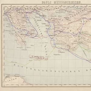
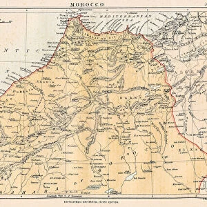
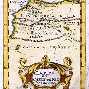
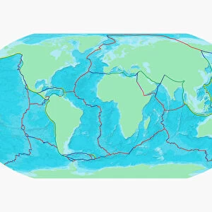
This print by Tetra Images takes us on a journey through time and space. The close-up shot of an antique world map transports us back to a bygone era, where the art of cartography was revered for its precision and beauty. The intricate details of this historic map showcase the vastness of our planet, with continents like Europe, North America, South America, and Africa clearly defined. The Atlantic Ocean stretches across the center, symbolizing both the challenges and opportunities that lay ahead for explorers in centuries past. As we study this studio shot closely, we can almost feel the weight of history in our hands. The aged paper exudes a sense of authenticity and importance as it reveals the physical geography of different regions. It serves as a reminder that maps were once essential tools for planning journeys and strategizing routes. In today's fast-paced world, this image encourages us to pause and appreciate the guidance provided by these antique maps. They remind us that even in an age dominated by technology, there is still value in understanding our world from a broader perspective. Whether displayed in homes or offices, this print invites contemplation about our place within global history. Its timeless appeal captures both wanderlust and curiosity about distant lands waiting to be explored.
MADE IN THE USA
Safe Shipping with 30 Day Money Back Guarantee
FREE PERSONALISATION*
We are proud to offer a range of customisation features including Personalised Captions, Color Filters and Picture Zoom Tools
SECURE PAYMENTS
We happily accept a wide range of payment options so you can pay for the things you need in the way that is most convenient for you
* Options may vary by product and licensing agreement. Zoomed Pictures can be adjusted in the Cart.