Home > Europe > United Kingdom > England > London > Related Images
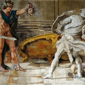
Map To Illustrate the German Submarine Blockade and the British Minefields... 1919

![]()
Wall Art and Photo Gifts from Heritage Images
Map To Illustrate the German Submarine Blockade and the British Minefields... 1919
Map To Illustrate the German Submarine Blockade and the British Minefields as a Measure of Protection, 1919. Map of the Atlantic Ocean during the First World War, 1914-1919, showing part of the east coast of the United States, Great Britain and western Europe. From " The History of the Great European War: its causes and effects", Vol. VII, by W. Stanley Macbean Knight. [Caxton Pulishing Company, Limited, London, 1919]
Heritage Images features heritage image collections
Media ID 19047567
© The Print Collector/Heritage Images
Atlantic Ocean Blockade Caxton Publishing Company Caxton Pulishing Company Caxton Pulishing Company Lim Caxton Pulishing Company Limited Caxton Pulishing Company Ltd Great Britain Knight Limited London Geographical Institute Mine Mines Ocean Stanley Macbean Stanley Macbean Knight W Stanley Macbean W Stanley Macbean Knight William Stanley Macbean William Stanley Macbean Knight 1st World War Minefield
EDITORS COMMENTS
This print showcases a historical map titled "Map To Illustrate the German Submarine Blockade and the British Minefields. . . 1919". Created by W. Stanley Macbean Knight, it was published in London by Caxton Publishing Company in 1919 as part of his book "The History of the Great European War: its causes and effects". The map depicts the Atlantic Ocean during World War I (1914-1919), focusing on the eastern coast of the United States, Great Britain, and western Europe. Its purpose is to highlight two crucial defensive measures employed during this tumultuous period: the German submarine blockade and British minefields. In vibrant colors, this print offers a visual representation of how these strategies were implemented to protect vital sea routes against enemy forces. The intricate details showcase various locations, countries, continents, and bodies of water involved in this global conflict. As an invaluable historical artifact from one of humanity's most significant conflicts, this print provides a glimpse into the challenges faced by nations at war. It serves as a reminder of both the ingenuity employed to safeguard territories and trade routes and the devastating impact that warfare can have on societies worldwide. Preserved by The Print Collector under their vast collection dedicated to documenting history through visual media, this image stands as a testament to our collective past while offering valuable insights for future generations studying World War I.
MADE IN THE USA
Safe Shipping with 30 Day Money Back Guarantee
FREE PERSONALISATION*
We are proud to offer a range of customisation features including Personalised Captions, Color Filters and Picture Zoom Tools
SECURE PAYMENTS
We happily accept a wide range of payment options so you can pay for the things you need in the way that is most convenient for you
* Options may vary by product and licensing agreement. Zoomed Pictures can be adjusted in the Cart.