Home > Architecture > Towers > Castles
Bristol BS15 1 Map

![]()
Wall Art and Photo Gifts from Map Marketing
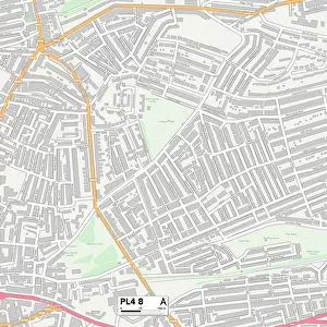
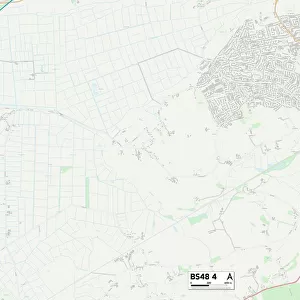
Bristol BS15 1 Map
Postcode Sector Map of Bristol BS15 1
Media ID 19966554
Albany Street Beaufort Road Bourne Close Brighton Place Bristol Broad Road Castle Road Charlton Road Chase Road Clare Road Clarence Road Cross Street Crown Road Dorset Road Duncombe Road Elton Road Field Road Gilbert Road Gladstone Road Glenburn Road Grantham Road Hampton Street Hill View John Street Kiln Close Kimberley Road King Street Kingsmead Road Kingsway Avenue Lansdown Close Lansdown Road Launceston Road Lodge Hill Lodge Road London Street May Street Neville Road Norman Grove North Park Pembroke Road Primrose Close Primrose Lane Prospect Avenue Queen Street Regent Street Rodney Road Selkirk Road Seymour Road Sherwood Road Speedwell Road Spring Hill St Michaels Drive St Stephens Road Sunny Bank Talbot Avenue Tower Road Unity Street Victoria Park Watts Lane Wellington Road Woodland Way Worcester Road Deerhurst Nympsfield
FEATURES IN THESE COLLECTIONS
> Architecture
> Towers
> Castles
> Architecture
> Towers
> Victoria Tower
> Arts
> Artists
> B
> John Brooks
> Arts
> Artists
> C
> John Charlton
> Arts
> Artists
> F
> John Field
> Arts
> Artists
> G
> John Gilbert
> Arts
> Artists
> H
> John Hillers
> Arts
> Artists
> H
> John Hills
> Arts
> Artists
> L
> John Lodge
> Arts
> Artists
> M
> Michael Maier
> Map Marketing
> Postcode Sector Maps
> BS - Bristol
MADE IN THE USA
Safe Shipping with 30 Day Money Back Guarantee
FREE PERSONALISATION*
We are proud to offer a range of customisation features including Personalised Captions, Color Filters and Picture Zoom Tools
SECURE PAYMENTS
We happily accept a wide range of payment options so you can pay for the things you need in the way that is most convenient for you
* Options may vary by product and licensing agreement. Zoomed Pictures can be adjusted in the Cart.