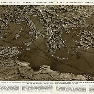
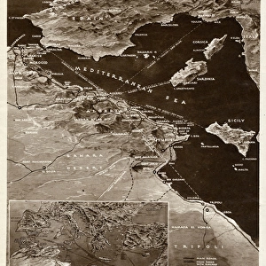
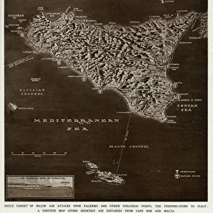
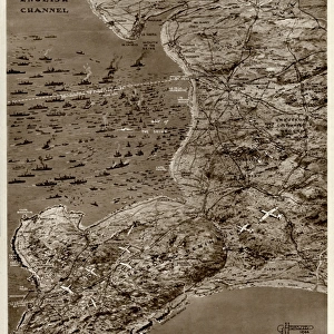
Maps of Sicilian Straits and Mediterranean by G. H. Davis

![]()
Wall Art and Photo Gifts from Mary Evans Picture Library
Maps of Sicilian Straits and Mediterranean by G. H. Davis
A map of the Sicilian Straits: the vital channel in the Mediterranean War. Also a map of the general Mediterranean area. Date: 1941
Mary Evans Picture Library makes available wonderful images created for people to enjoy over the centuries
Media ID 14133113
© Illustrated London News Ltd/Mary Evans
1941 Area Channel Davis Mediterranean Sicilian Sicily Straits Strategy Vital
EDITORS COMMENTS
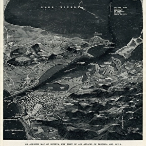
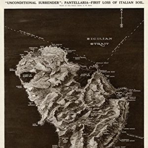
This print showcases two maps by the renowned cartographer G.H. Davis, published in 1941. The first map, titled "A Map of the Sicilian Straits: The Vital Channel in the Mediterranean War," offers a detailed view of the Sicilian Straits, the narrow waterway separating Sicily from the Italian mainland and the southern approach to the Mediterranean Sea. The strategic importance of this region during the Mediterranean War, particularly during World War II, is highlighted by the map's title. The second map, titled "General Mediterranean Area," provides a broader perspective, illustrating the Mediterranean Sea and its surrounding lands, including Europe, North Africa, and the Middle East. The maps' intricate detailing and accurate representation of geographical features make them valuable historical documents, offering insight into the strategic considerations of the Mediterranean War during this pivotal period in world history. G.H. Davis, a prolific cartographer, produced numerous maps during the early 20th century, many of which were used for military purposes. These maps, published in 1941, were likely created to aid in the planning and execution of military campaigns during the Second World War. The maps' inclusion of place names, political boundaries, and topographical features make them essential resources for understanding the geopolitical landscape of the Mediterranean region during this time. The vintage appearance of the print, with its aged paper texture and subtle toning, adds to its historical charm, making it an intriguing addition to any collection of historical maps or military memorabilia. Whether used for educational or decorative purposes, this print serves as a captivating reminder of the rich history and strategic significance of the Mediterranean region during the 20th century.
MADE IN THE USA
Safe Shipping with 30 Day Money Back Guarantee
FREE PERSONALISATION*
We are proud to offer a range of customisation features including Personalised Captions, Color Filters and Picture Zoom Tools
SECURE PAYMENTS
We happily accept a wide range of payment options so you can pay for the things you need in the way that is most convenient for you
* Options may vary by product and licensing agreement. Zoomed Pictures can be adjusted in the Cart.