Home > Aerial Photography > Related Images
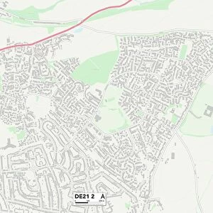
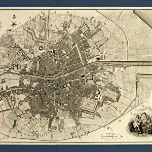
Lincoln Nebraska US City Street Map

![]()
Wall Art and Photo Gifts from Fine Art Storehouse
Lincoln Nebraska US City Street Map
Vector Illustration of a City Street Map of Lincoln, Nebraska, USA. Scale 1:60, 000.
All source data is in the public domain.
U.S. Geological Survey, US Topo
Used Layers:
USGS The National Map: National Hydrography Dataset (NHD)
USGS The National Map: National Transportation Dataset (NTD)
Unleash your creativity and transform your space into a visual masterpiece!
Frank Ramspott
Media ID 15215808
© Frank Ramspott, all rights reserved
Aerial View City Map Computer Graphic Directly Above Downtown District Gray Lincoln Nebraska Road Map Text Digitally Generated Image Green Color White Color
FEATURES IN THESE COLLECTIONS
> Aerial Photography
> Related Images
> Animals
> Insects
> Hemiptera
> Green Scale
> Arts
> Contemporary art
> Digital artwork
> Street art
> Arts
> Landscape paintings
> Waterfall and river artworks
> River artworks
> Arts
> Portraits
> Pop art gallery
> Street art portraits
> Arts
> Street art graffiti
> Digital art
> Digital paintings
> Arts
> Street art graffiti
> Digital art
> Vector illustrations
> Fine Art Storehouse
> Map
> Street Maps
> Fine Art Storehouse
> Map
> USA Maps
> Maps and Charts
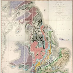
> Geological Map
> Maps and Charts
> Related Images
> North America
> United States of America
> Lakes
> Related Images
EDITORS COMMENTS
This print showcases a meticulously detailed vector illustration of the vibrant city street map of Lincoln, Nebraska, USA. With a scale of 1:60,000, every intricate aspect is brought to life in this digitally generated image by Frank Ramspott. The print encompasses the downtown district, featuring its bustling streets and charming architecture. A serene lake and river gracefully flow through the cityscape, adding an element of tranquility amidst the urban landscape. The design incorporates various layers sourced from USGS The National Map: National Hydrography Dataset (NHD) and National Transportation Dataset (NTD), both freely available in the public domain. This ensures accuracy and reliability in depicting road networks and hydrographic features. Rendered in shades of gray with pops of blue, white, and green accents, this aerial view offers a unique perspective directly above Lincoln's dynamic streetscape. The inclusion of text enhances navigability while maintaining an aesthetically pleasing composition. Ideal for enthusiasts of cartography or those with an affinity for their hometowns or favorite cities around the world, this visually striking artwork captures not only Lincoln's physical geography but also its spirit as a thriving Midwestern metropolis. Whether displayed at home or office spaces, this print adds sophistication to any interior decor setting without mentioning commercial use - it truly celebrates the beauty and artistry found within maps themselves.
MADE IN THE USA
Safe Shipping with 30 Day Money Back Guarantee
FREE PERSONALISATION*
We are proud to offer a range of customisation features including Personalised Captions, Color Filters and Picture Zoom Tools
SECURE PAYMENTS
We happily accept a wide range of payment options so you can pay for the things you need in the way that is most convenient for you
* Options may vary by product and licensing agreement. Zoomed Pictures can be adjusted in the Cart.