Home > Europe > United Kingdom > England > London > Towns > Camberwell
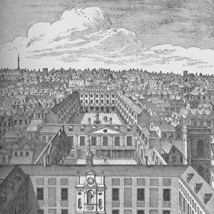
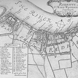
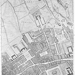
A Map of Bermondsey, London, 1746 (engraving)
")
![]()
Wall Art and Photo Gifts from Fine Art Finder
A Map of Bermondsey, London, 1746 (engraving)
XJF438442 A Map of Bermondsey, London, 1746 (engraving) by Rocque, John (c.1704-d.1762); Private Collection; British, out of copyright
Media ID 12881125
© www.bridgemanimages.com
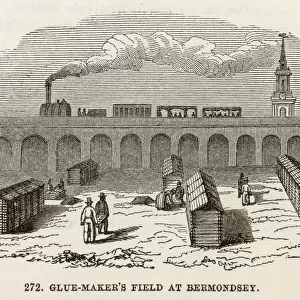
Aerial View Area Bermondsey Camberwell Farm Land Farmland Fields Outskirts Suburb The Grange Turnpike Neckinger
FEATURES IN THESE COLLECTIONS
> Aerial Photography
> Related Images
> Arts
> Artists
> F
> John Field
> Arts
> Artists
> R
> John Rocque
> Europe
> France
> Canton
> Landes
> Europe
> United Kingdom
> England
> Kent
> Grange
> Europe
> United Kingdom
> England
> London
> Towns
> Bermondsey
> Europe
> United Kingdom
> England
> London
> Towns
> Camberwell
> Maps and Charts
> Related Images
EDITORS COMMENTS
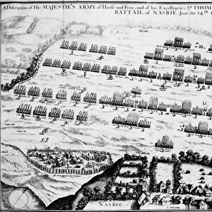
This print takes us back in time to the year 1746, offering a glimpse into the historical landscape of Bermondsey, London. The intricate engraving by John Rocque showcases the city's evolution during this era, capturing its essence with remarkable detail. As we delve into this visual treasure trove, our eyes wander across the map's expansive canvas. From the bustling heart of the city to its tranquil outskirts and sprawling fields, every inch tells a story of urban growth and rural charm. The old Kent Road winds its way through neighborhoods like Blue Anchor and New Neckinger, revealing their importance as vital arteries connecting different parts of Bermondsey. Our gaze is drawn towards significant landmarks such as Tanners Yard and Turnpike, reminding us of their pivotal roles in shaping daily life for residents at that time. The Grange stands proudly amidst lush surroundings while Hop Walk exudes an air of agricultural prosperity with its flourishing farmland. Beyond Bermondsey's borders lies Cherry Garden and Camberwell, extending our understanding beyond one area to encompass neighboring regions. This aerial view provides a unique perspective on SE1's layout and highlights how interconnected these districts were even centuries ago. Intriguingly rich in history and meticulously crafted by Rocque's skilled hand, this engraving transports us back to an era when London was still taking shape. It serves as a testament to both artistic prowess and cartographic precision—a true masterpiece preserved within private collections for all admirers to appreciate today.
MADE IN THE USA
Safe Shipping with 30 Day Money Back Guarantee
FREE PERSONALISATION*
We are proud to offer a range of customisation features including Personalised Captions, Color Filters and Picture Zoom Tools
SECURE PAYMENTS
We happily accept a wide range of payment options so you can pay for the things you need in the way that is most convenient for you
* Options may vary by product and licensing agreement. Zoomed Pictures can be adjusted in the Basket.