Home > Europe > United Kingdom > England > Sussex > Charlton
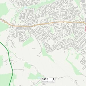
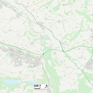
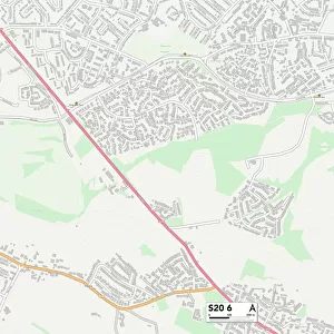
Sheffield S35 2 Map

![]()
Wall Art and Photo Gifts from Map Marketing
Sheffield S35 2 Map
Postcode Sector Map of Sheffield S35 2
Media ID 19978920
Aire Close Arundel Road Avon Grove Belmont Avenue Bowland Drive Bridle Close Brookdale Road Chamberlain Court Churchill Way Commerce Street Cotswold Avenue Derwent Drive Fairfield Hall View Harlech Close King Street Kirby Lane Lane End Leyburn Grove Livingstone Road Market Place Market Street Mount Pleasant Close Mount Road Nelson Place Newton Close Park Lane Park Square Queen Street Rockwood Close Sheffield Smith Street Stanley Road Station Road Sussex Road Thorncliffe Road Vernon Drive Warren Lane Westbrook Road Wharfedale Drive White Lane Wood Close Woodburn Drive Chapeltown Warren
FEATURES IN THESE COLLECTIONS
> Europe
> United Kingdom
> England
> Avon
> Europe
> United Kingdom
> England
> Sussex
> Arundel
> Europe
> United Kingdom
> England
> Sussex
> Brook Street
> Europe
> United Kingdom
> England
> Sussex
> Charlton
> Europe
> United Kingdom
> England
> Sussex
> Related Images
> Europe
> United Kingdom
> England
> Sussex
> Street End
> Europe
> United Kingdom
> England
> West Sussex
> Arundel
> Europe
> United Kingdom
> England
> West Sussex
> Related Images
> Europe
> United Kingdom
> Scotland
> Aberdeenshire
> Blackburn
> Europe
> United Kingdom
> Scotland
> West Lothian
> Blackburn
> Map Marketing
> Postcode Sector Maps
> S - Sheffield
MADE IN THE USA
Safe Shipping with 30 Day Money Back Guarantee
FREE PERSONALISATION*
We are proud to offer a range of customisation features including Personalised Captions, Color Filters and Picture Zoom Tools
SECURE PAYMENTS
We happily accept a wide range of payment options so you can pay for the things you need in the way that is most convenient for you
* Options may vary by product and licensing agreement. Zoomed Pictures can be adjusted in the Cart.