Home > Europe > United Kingdom > England > Aviation
Training of Aerial Photographers to Create Overlapping M?

![]()
Wall Art and Photo Gifts from Mary Evans Picture Library
Training of Aerial Photographers to Create Overlapping M?
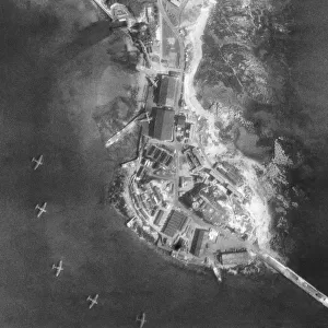
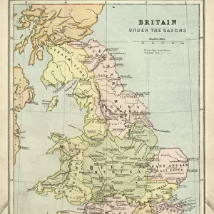
Training of Aerial Photographers to Create Overlapping Mosaics of Vertical Aerial Photographs to Make Maps at the RAF School of Photography at Farnborough, UK Aerial-Photography Date: 1936
Mary Evans Picture Library makes available wonderful images created for people to enjoy over the centuries
Media ID 18410551
© aviation-images.com / Mary Evans Picture Library
Aerial Photography Eglf Farnborough 1936 Aerolane
FEATURES IN THESE COLLECTIONS
> Aerial Photography
> England
> Aerial Photography
> Related Images
> Europe
> United Kingdom
> England
> Aviation
> Europe
> United Kingdom
> England
> Maps
> Europe
> United Kingdom
> England
> Posters
> Europe
> United Kingdom
> England
> Related Images
> Europe
> United Kingdom
> Maps
> Maps and Charts
> Related Images
> Mary Evans Prints Online
> Aviation Images
EDITORS COMMENTS
This print captures a moment in history at the RAF School of Photography in Farnborough, UK, dating back to 1936. The image showcases the meticulous training of aerial photographers as they work together to create overlapping mosaics of vertical aerial photographs for map-making purposes.
The dedication and precision exhibited by these photographers is truly remarkable, highlighting the importance of their role in capturing crucial information from above. As they carefully maneuver through the process, it is evident that each individual plays a vital part in ensuring the success of creating accurate maps using this innovative technique.
The aircraft seen in the background serves as a reminder of the advancements made in aviation during this time period, further emphasizing the significance of aerial photography in various fields such as military operations and geographical surveying.
This photograph not only documents a specific training session but also provides viewers with a glimpse into the past, offering insight into how technology and techniques have evolved over time. It serves as a testament to the skill and expertise required to excel in this specialized field, showcasing the dedication and teamwork necessary for creating precise aerial maps.
MADE IN THE USA
Safe Shipping with 30 Day Money Back Guarantee
FREE PERSONALISATION*
We are proud to offer a range of customisation features including Personalised Captions, Color Filters and Picture Zoom Tools
FREE COLORIZATION SERVICE
You can choose advanced AI Colorization for this picture at no extra charge!
SECURE PAYMENTS
We happily accept a wide range of payment options so you can pay for the things you need in the way that is most convenient for you
* Options may vary by product and licensing agreement. Zoomed Pictures can be adjusted in the Cart.