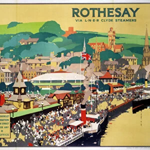
Home > Europe > United Kingdom > Scotland > Strathclyde > Rothesay
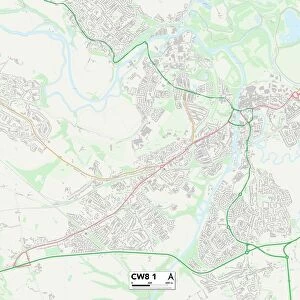
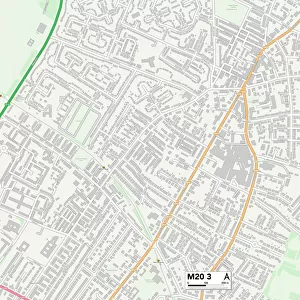
Trafford M33 4 Map

![]()
Wall Art and Photo Gifts from Map Marketing
Trafford M33 4 Map
Postcode Sector Map of Trafford M33 4
Media ID 19974276
Ainsdale Drive Aintree Avenue Alma Road Alston Avenue Ascot Avenue Ashley Drive Ashwood Avenue Beechfield Birkdale Drive Blair Close Braemar Drive Campbell Road Central Avenue Cherry Lane Chester Avenue Chestnut Drive Chichester Close Clough Avenue Coppice Avenue Drayton Close Eastway Elton Road Fairway Drive Forest Drive Fulmar Drive Glencoe Drive Goodwood Avenue Granary Way Greenway Close Hartford Road Hexham Close Hurst Avenue Kempton Avenue Kenmore Road Kingston Close Langdale Road Lingfield Avenue Link Road Manley Road Mayfair Drive Meadway Meadway Close Moreton Avenue Moss Lane Newbury Avenue Newmarket Close Overton Crescent Parklands Drive Raglan Road Repton Close Riley Close Rochester Drive Sandown Drive Spinney Drive St Andrews Close The Avenue The Drive Thornham Road Tiverton Avenue Tiverton Drive Trafford Walton Road Westbury Avenue Willow Drive Woodhouse Lane
FEATURES IN THESE COLLECTIONS
> Arts
> Landscape paintings
> Forest and woodland scenes
> Forest artwork
> Europe
> United Kingdom
> Scotland
> Fife
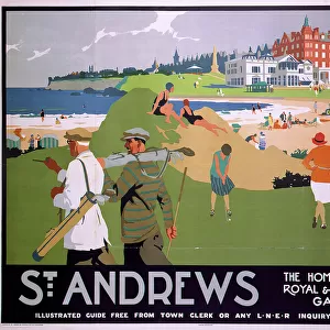
> St Andrews
> Europe
> United Kingdom
> Scotland
> Strathclyde
> Rothesay
> Europe
> United Kingdom
> Wales
> Monmouthshire
> Chepstow
> Map Marketing
> Postcode Sector Maps
> M - Manchester
> Maps and Charts
> Related Images
MADE IN THE USA
Safe Shipping with 30 Day Money Back Guarantee
FREE PERSONALISATION*
We are proud to offer a range of customisation features including Personalised Captions, Color Filters and Picture Zoom Tools
SECURE PAYMENTS
We happily accept a wide range of payment options so you can pay for the things you need in the way that is most convenient for you
* Options may vary by product and licensing agreement. Zoomed Pictures can be adjusted in the Cart.