Home > Animals > Mammals > Muridae > Plains Mouse
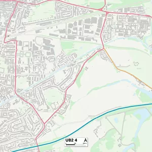
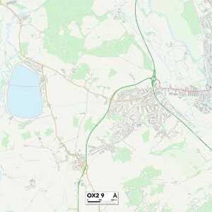
Oxford OX4 1 Map

![]()
Wall Art and Photo Gifts from Map Marketing
Oxford OX4 1 Map
Postcode Sector Map of Oxford OX4 1
Media ID 19977168
Alma Place Argyle Street Aston Street Bannister Close Bath Street Bedford Street Caroline Street Chapel Street Chester Street Collins Street Cowley Road Cross Street Crown Street Dawson Street Denmark Street East Avenue Glebe Street Green Street Hawkins Street Henley Street Hill Top Road Hurst Street James Street Leopold Street Magdalen Road Minster Road Oxford Princes Street Randolph Street Rectory Road Regent Street Southfield Road St Marys Road Stanley Road Stone Street Stratford Street Temple Street The Plain Union Street Warwick Street York Place Headington Hill
FEATURES IN THESE COLLECTIONS
> Animals
> Mammals
> Muridae
> Plains Mouse
> Europe
> Denmark
> Related Images
> Map Marketing
> Postcode Sector Maps
> OX - Oxford
> Maps and Charts
> Related Images
MADE IN THE USA
Safe Shipping with 30 Day Money Back Guarantee
FREE PERSONALISATION*
We are proud to offer a range of customisation features including Personalised Captions, Color Filters and Picture Zoom Tools
SECURE PAYMENTS
We happily accept a wide range of payment options so you can pay for the things you need in the way that is most convenient for you
* Options may vary by product and licensing agreement. Zoomed Pictures can be adjusted in the Cart.